
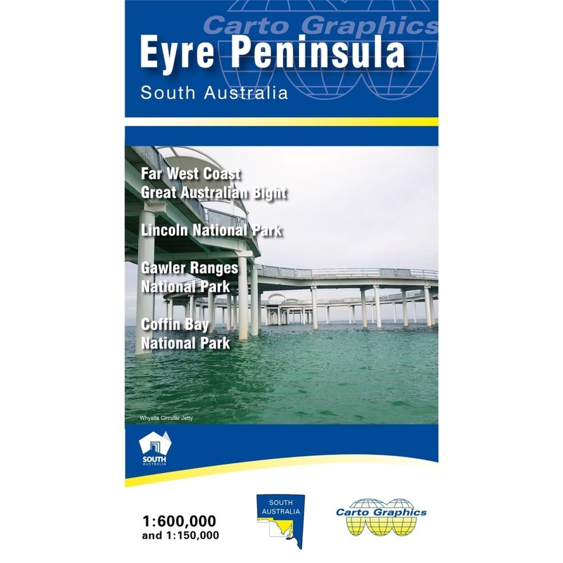
Description
Touring map from Carto Graphics (at 1:600,000 scale) of Eyre Peninsula, South Australia showing the full detail of major and minor roads (with names), national parks and conservation areas, hill shading, distance chart, town and locality index and more.
The reverse side has Far West Coast extension across to the Western Australia border plus detailed 1:150,000 scale maps of selected national parks; Lincoln, Coffin Bay and Gawler Ranges. 2021 edition.
KeyFeatures
- Major & Minor Roads
- National parks and conservation areas
- Hill Shading
- Town and locality index
- Inset maps for theCoffin Bay National Park (1:150,000 scale), Gawler Ranges National Park (1:150,000 scale), Lincoln National Park (1:150,000 scale) and Far West Coast (1:600,000 scale)
KeySpecifications
Edition: 2nd
Publication Date:01/01/21
Scale:1:600,000
Folded size (WxHxD): 130mmx 240mm x 4mm
Flatsize (WxH): 690mmx 1000mm
Weight: 0.08kgs
Reviews
There are no reviews yet.